
We love travelling and exploring new countries, unkown areas and stunning landscapes. Often we travel on small, sometimes forgotten tracks, if be car, by bike or on foot. So, offroad and outdoor navigation is from very high importance for us.
In this guide, I like to give you some ideas, how we handle navigation during our trips…
The tools
What do you need for offroad or outdoor navigation?
Many years ago, as we started to learn about outdoor navigation, we bought a first handheld GPS from Garmin. It was without displaying a map, but it already had an internal air pressure sensor to give accurate elevation data. For navigation, you had to put your waypoints one by one to the system and there of cause was only a point to point „routing“. Nothing for a longer or spontaneous trip.
Meanwhile, we use a software on our home PC and our travel laptop to collect waypoint and plan tracks. On tour, we just synchronize the data to our handheld GPS or the GPS app on the smartphone. Sync is possible by homecloud or several other cloud systems. We even use the same maps on all our systems…
How does this work?
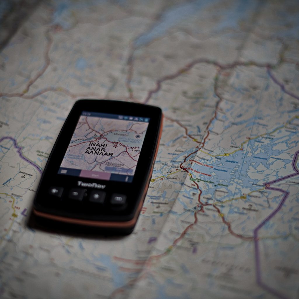
The planning

For planning of our trips, we collect interesting waypoints for example from Google Maps and other resources in the internet, but also from books, friends and so on. We organize all off them in a mapping software called „Land“ from Twonav. We also collect trip records from platforms like Wikiloc for our needs. In „Land“, we can bring all together, display them on scalable Maps like OSM, but also on topografic maps, which are close to that, what we know from the good, old paper‑map.
„Land“ is the central place for all of our navigation activities.
Travelling by car

For car navigation, we meanwhile use two apps. If we just travel from A to B on normal roads, Google Maps is for us a good help, especially with the quite good traffic indicator. If we leave normal roads, or if we don’t have a clear plan, we just switch over to the Twonav-App on our Android tablet. Now, we can use all information, synced from the „Land“ software to the tablet. All waypoint, tracks and most important, all the offline maps in very high quality. We even use high resolution satellite maps for orientation in unknown areas. And how to navigate with that?
One of our favorites at „Twonav“ is, that there is a easy way to layer a routable scalable map like a TomTom or OSM on a high resolution topografic map or an satellite picture. Routing on streets while having a precise view to the surrounding.
Perfect for us.
On tour by bike
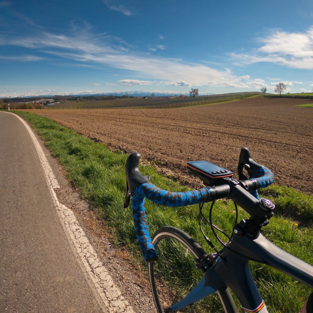
On tour with the bicyle, on the roadbike or gravelbike, we want to have a good idea, where to drive. Not always to stop at the next crossing to find out, where to drive. We mainly use handheld GPS on bike tours in unknown areas. At the beginning, we used systems from Garmin for that, but more than 10 years ago we switched over to the first (and benchmarking) GPS „Aventura“ from Twonav. As with car navigation, we enjoy the layered display of topografic maps with the comfort of on‑track navigation. Meanwhile, we use a new generation GPS, the Trail2 from Twonav for that. Better satellite reception and over‑the‑air sync of data was one of the main reasons.
On tour by foot
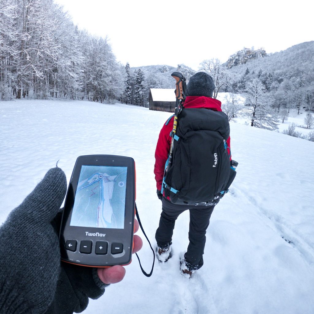
It is more or less the same, as with biking. In addition and especially on mountain tours it is very important not only to rely on the satellite based hight information. If you climb up the mountains, it becomes more important to have air pressure based elevation information. Especially under severe weather conditions like fog or an upcoming thunderstorm. This is one of the main reasons (beside the power capacity), why we use a handheld GPS during mountaineering instead of a smartphone.